*
Borders and other territorial markings can easily be seen from the present to be somewhat arbitrarily or even accidentally drawn on the land. This may be especially true when the disputes of the past are long forgotten or overcome. Yet the existence of such boundaries also, in some strange way, reflects the historical settlement of long-festering grievances and violent disputes, and in that respect usually brings an end to the most deadly of conflicts. Seen in this way, a border represents an agreement to butt out of each other’s business or at least to attempt in some measure to be more civil than those ancestors who turned borderlands – and certainly the border between Scotland and England – into a bloody, muddy and dangerous place, ‘the scene of plunder and bloodshed’, ravaged for long periods by ‘savage incursions of both kingdoms alternately.’
The uncertainty that became attached to the borderlands was something that seems to have contributed to the murky and unknown early history of the place now known as Cumbria, a part of England that even as recently as the 17th century was regarded as one of the ‘dark corners of the land.’
Cumbria, of course, was a place whose territorial boundaries frequently changed and whose land territory – or parts of it, at least – shifted back and forth between the two warring nations. It was a place that became, for a long time, a kind of lawless ambiguity. It was a land comprised of an indeterminate space that was nonetheless cut through by a real line on the ground in the form of Hadrian’s Wall, a fairly visible reminder of the struggles that the all-conquering Roman Empire had itself faced here in northern Britain. And some centuries after these invaders had abandoned their wall and their forts, just south of the present-day borderline that separates Scotland and England, was the place where Edward I – so-called ‘Hammer of the Scots’ – drew his last breath in 1307. He was 68 years of age – an old man at a time when the life expectancy for men was about half his years, bedridden with dysentery and rendered invisible enough that the rumour was that he was already dead. After rising from his sickbed to drive his men to war in person, he headed out west from Carlisle, making for the Cumbrian coast to sail across the Solway Firth to Scotland.
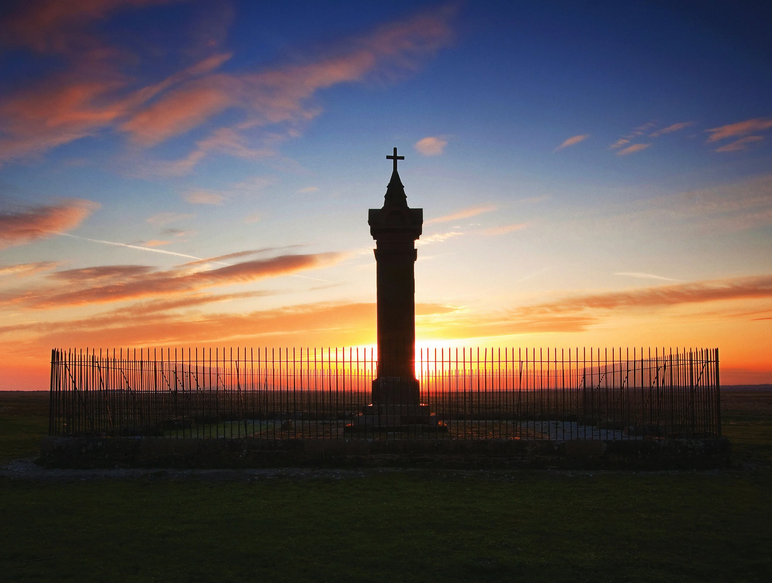
But he never made it and ‘was forced to stop at Burgh by Sands, an isolated settlement close to the Cumbrian coast’, the ‘windswept wilderness’ where he spent his last night on Earth. The field at Burgh by Sands in which he died, set in a patch of land that served as some kind of base for military forays in all directions at that time, is today marked with a modest memorial to the man described as a great and terrible king.
Elsewhere, away from its northern borderlands, Cumbria remained susceptible to invasion from a coastline that faced the Irish Sea and connected it to the larger waters beyond, which carried Scandinavian and Irish colonists onto its territory between the 5th and 8th centuries, which is to say, the Early Middle Ages. The last military invasion was by an expedition of the American Continental Navy in April 1778 during the American War of Independence, led by a transplanted Scot and former Cumbrian seaman named John Paul Jones, who brought his men ashore at Whitehaven with the intention of burning every ship in the harbour.